This is about the ancient Egyptian capital on the Nile, roughly twenty five kilometres south of Cairo. Not the city in Tennessee, and not the school of a similar name.
Memphis egypt founded at the point where the valley opens into the Delta was the first capital of a unified country and stayed the administrative centre for most of three thousand years. Today it is a village called Mit Rahina, some palm groves, a museum garden and a very large amount of archaeology under farmland.
The contrast between what it was and what is visible is the single most interesting thing about the place.
Where Is Memphis Egypt, Exactly
On the west bank of the Nile, in Giza Governorate, centred on the modern villages of Mit Rahina and Badrashein. By road it is around forty five minutes from central Cairo depending on traffic.
The position was chosen for control rather than comfort. This is the hinge point of the country: the last of the narrow valley and the first of the Delta, where anything moving north or south on the river has to pass. Whoever held it held both halves.
Saqqara is three kilometres away. Dahshur is about ten beyond that. Giza is roughly twenty north. All of them are cemeteries of this one city, which is the fact that reorganises the whole map in your head.
The Founding, and the Two Names
Tradition credits the founding to Menes around 3100 BC, the king who unified Upper and Lower Egypt and is usually identified with Narmer. The date is conventional rather than exact and the archaeology is messier than the story.
Its first name was Inebu hedj, the white walls, probably describing a whitewashed mud brick fortification. The name Memphis comes later and by a longer route: Men nefer, enduring and beautiful, was the name of the pyramid town of Pepi I at Saqqara, and it spread to the city as a whole before the Greeks turned it into Memphis.
The temple at the centre was Hut ka Ptah, the house of the spirit of Ptah. The Greeks rendered that as Aigyptos, and that word is why the country is called Egypt in English instead of Misr.
So the modern name of the country is a Greek mangling of the name of one temple in this village.
What Memphis Ancient Egypt Ran From Here
Everything, for a long time. Memphis ancient egypt governed from was the seat of the treasury, the granaries, the workshops and the office that organised pyramid building, which was the largest sustained industrial project of the ancient world.
Ptah was the patron god: craftsman, sculptor, the one who made the world by speaking it. His high priest carried the title greatest of the directors of craftsmanship, which tells you what the city thought of itself.
The Apis bull lived in the temple precinct as Ptah made flesh. One animal at a time, chosen by its markings, consulted as an oracle, and on its death embalmed and carried up to Saqqara for burial in a granite sarcophagus weighing tens of tonnes.
Even after Thebes became the religious capital in the New Kingdom, kings were crowned at Memphis and the administration stayed. Thebes had the gods. This place had the paperwork.
The workshops mattered as much as the offices. Sculptors, goldsmiths, faience makers and shipwrights worked here, and the standard of craftsmanship the country is famous for was set in this city and exported up the river.
Foreigners lived here too, in quarters of their own. Phoenicians, Carians and Greeks had communities here in the Late Period, and a Persian garrison sat on the palace mound after 525 BC. This was a port city and a capital at once, a combination Egypt would not have again until Alexandria.
Why the City Disappeared
Three reasons, stacked.
The first is material. The city was built almost entirely of mud brick, which returns to mud. Only temples and statues were stone, and stone was valuable.
The second is the founding of Alexandria in 331 BC and the shift of power to the coast, followed centuries later by the founding of Fustat and then Cairo just downriver. A declining city next to a growing one becomes a quarry. Memphis limestone is in medieval Cairo.
The third is water. The Nile has shifted its channel eastwards over the millennia and the water table has risen, so a large part of what remains sits below the groundwater, waterlogged and effectively unexcavatable with current methods.
Herodotus walked around the temple of Ptah in the fifth century BC and described it as vast. Almost none of what he saw is above ground now.
Decline was slow rather than dramatic. The temple of Ptah was still functioning in the Roman period, and the site was a bishopric under Byzantine rule before the Arab conquest. There was no sack, no fire and no abandonment date.
What there was instead was five hundred years of people taking stone from a building nobody was maintaining. By the twelfth century the Arab physician and historian Abd al Latif al Baghdadi was describing the ruins as still astonishing, and complaining that they were being dismantled around him. He was right on both counts.
Reading a Memphis Egypt Map
Any memphis egypt map you look at will show three things worth separating in your mind.
First, the modern villages, which sit directly on top of parts of the ancient city. Second, the enclosures of excavated ground: the temple of Ptah area, the palace of Apries on its mound, the embalming house of the Apis bulls. Third, the necropolis strip running along the desert edge to the west, thirty kilometres of it from Giza in the north to Dahshur in the south.
The strip is the part that survived, because it was built in the desert out of stone. The city is the part that did not, because it was built on the floodplain out of mud.
Hold those two facts together and the whole landscape makes sense.
One more thing a map will not show you. The Nile in antiquity ran closer to the desert edge than it does now, so the city stood on the river and the cemeteries stood directly above it on the escarpment. A funeral was a short crossing and a climb, not the journey across farmland it would be today.
The river has moved several kilometres east since then. Every distance on a modern map between the city and its tombs is longer than the one the people who used them walked.
The Necropolis Belt in One Sentence
Giza, Abusir, Saqqara and Dahshur are four stretches of a single continuous cemetery serving one city over about a thousand years, with the fashion for where to be buried moving up and down the ridge as each king chose his ground.
Sneferu built at Dahshur in the south. His son Khufu moved twenty kilometres north to Giza. The Fifth Dynasty went to Abusir, in between, and the Sixth came back to Saqqara.
Treating them as four separate sites, which every itinerary does, hides the pattern. They are one cemetery with a very long address, and the address is this city.
What There Is to See Today
The museum garden at Mit Rahina, and not a great deal else that is open.
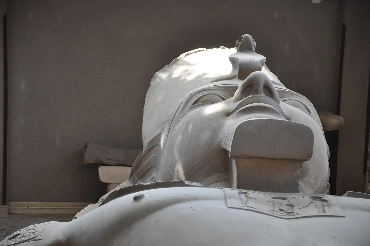
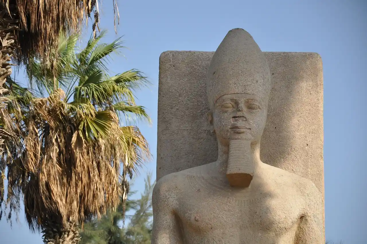
Its two great objects are a fallen limestone colossus of Ramesses II, about ten metres long, displayed on its back in a covered hall with a viewing gallery above it, and an alabaster sphinx of around eighty tonnes standing outside in the garden. Around them are sarcophagi, column capitals, sphinx fragments and the alabaster table on which the Apis bulls were embalmed.
The full detail of what is in the garden, and the order to look at it in, is in the guide to the site museum. Allow forty minutes.
Outside the museum enclosure, the excavated areas are mostly closed or unmarked, and what you can see from the road is low brick, water and palms.
The palace of Apries sits on a mound to the north, a Twenty Sixth Dynasty building on a platform that still stands well above the fields. Excavation there has been intermittent for over a century. It is not a visitor site and you will see it, if at all, from the vehicle.
The temple of Ptah enclosure has been dug in patches since the nineteenth century, and its west gate, built by Ramesses II, produced most of the large statuary now in the garden. Groundwater has stopped most of that work.
Whole areas are still unrecorded. This is not a finished excavation with a visitor centre, it is an active problem archaeologists have argued about for a hundred and fifty years, and the reason it looks like farmland is that it is farmland.
Memphis Old Egypt Visitors Expect Versus What Is There
Manage this before you arrive and the visit is excellent. Do not, and it is a disappointment.
People who book memphis old egypt itineraries are usually picturing a ruined city: streets, foundations, a temple you can walk through. That does not exist here. What exists is a garden of rescued objects beside a working village.
The right way to take it is as the first stop of three. Memphis, then Saqqara, then Dahshur, in that order, as one long day out of Cairo.
Done that way the logic is beautiful. Here is the city. Up the hill is its cemetery, where the officials who worked in these offices were buried. Ten kilometres further are the two pyramids where the technique was worked out by trial and error, covered in the Dahshur guide.
Done in the other order, or on its own, it is forty minutes looking at a statue.
Practical Notes
Tickets are bought at the gate and are cheap by comparison with the headline sites. Card payment has become the norm across the Cairo area, so do not arrive relying on cash.
The garden is flat and short, which makes it one of the easier ancient sites for anyone with limited mobility. There are souvenir stalls between the car park and the entrance and no way to avoid them.
Shade is limited outside the colossus hall. From May to September, do this stop first thing.
The Cairo area guide covers how this day compares with the Giza plateau and the museums. Our longer Egypt itineraries run the three sites as one full day with a proper lunch in between.
One Thing to Do Before You Leave
Walk to the edge of the museum enclosure and look east, across the fields, towards the river.
That flat green ground is the city. Not beside it, under it. Streets, workshops, granaries, houses, the temple Herodotus described, all of it a few metres down in wet silt, with a hundred generations of farmers on top.
Then turn and look west at the desert edge, where the pyramids of Saqqara stand up out of the sand in a line.
The dead are visible and the living are not. That is the whole history of this place in one turn of the head, and it takes about fifteen seconds once you know where to stand.